

Todd County C-18 Groundwater Atlas
The atlas includes the following pieces, printed by OceanGrafix. Atlas contents:
Part B Groundwater/Hydrogeology: 2010
Plate 7 – Distribution of the Surficial and Buried Sand Aquifers 36x33
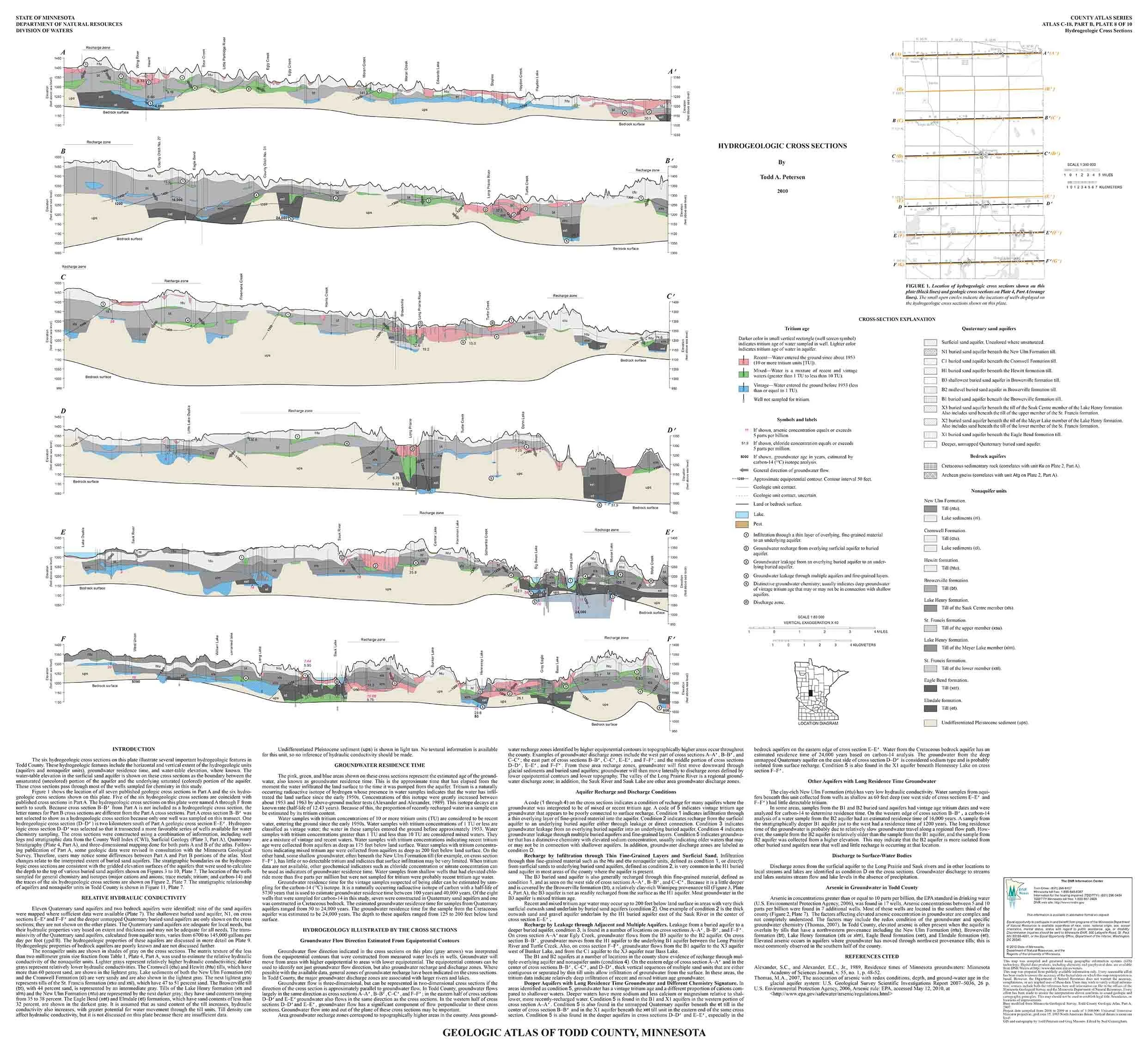
Plate 8 – Hydrogeologic Cross Sections 36x33
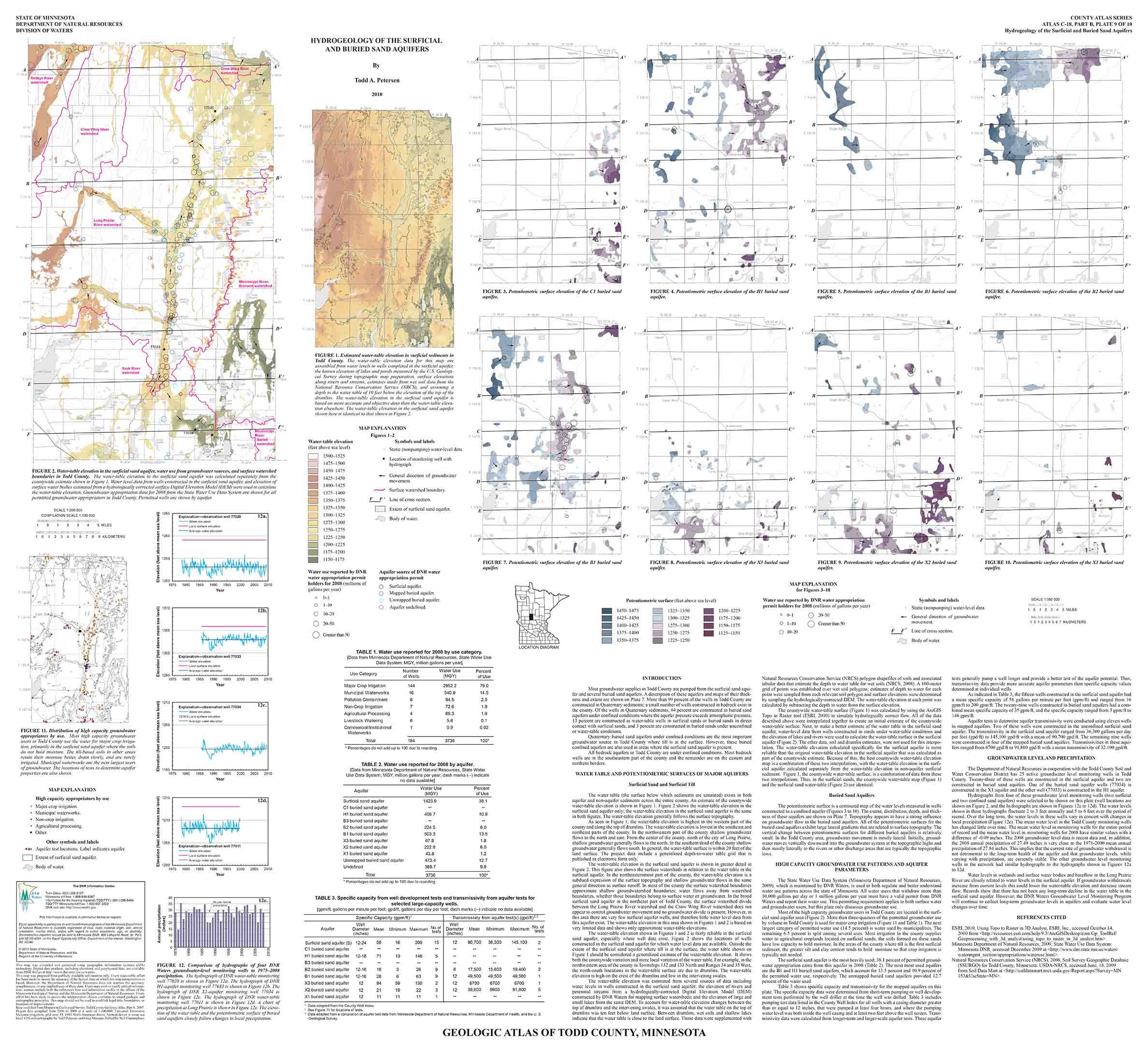
Plate 9 – Hydrogeology of the Surficial and Buried Sand Aquifers 36x33
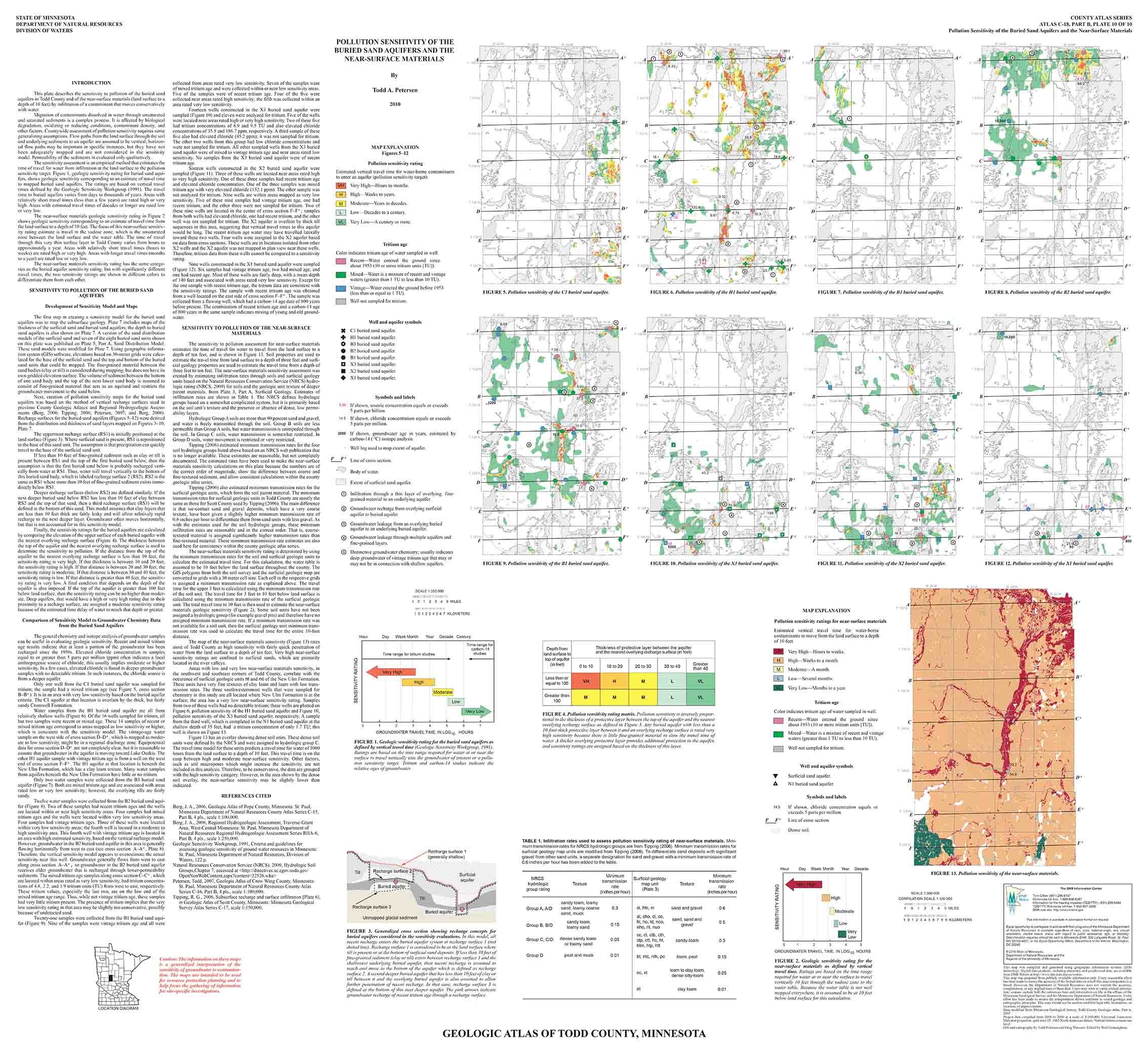
Plate 10 - Pollution Sensitivity of the Buried Sand Aquifers and the Near-Surface Materials 36x33
These county atlases are provided by the Minnesota Department of Natural Resources.
The Minnesota DNR produces the Part B atlases (Groundwater), which includes plates and reports identifying the direction of groundwater flow, aquifer properties, groundwater chemistry, and pollution sensitivity of aquifers. In older atlases the groundwater information is included in Part A (Geology, published by the Minnesota Geological Survey). See the Groundwater Atlas User Guide (PDF) for an overview of reading Part B (8 pages) and digital versions of the atlases at mndnr.gov/groundwatermapping.
The atlas includes the following pieces, printed by OceanGrafix. Atlas contents:
Part B Groundwater/Hydrogeology: 2010
Plate 7 – Distribution of the Surficial and Buried Sand Aquifers 36x33
Plate 8 – Hydrogeologic Cross Sections 36x33
Plate 9 – Hydrogeology of the Surficial and Buried Sand Aquifers 36x33
Plate 10 - Pollution Sensitivity of the Buried Sand Aquifers and the Near-Surface Materials 36x33
These county atlases are provided by the Minnesota Department of Natural Resources.
The Minnesota DNR produces the Part B atlases (Groundwater), which includes plates and reports identifying the direction of groundwater flow, aquifer properties, groundwater chemistry, and pollution sensitivity of aquifers. In older atlases the groundwater information is included in Part A (Geology, published by the Minnesota Geological Survey). See the Groundwater Atlas User Guide (PDF) for an overview of reading Part B (8 pages) and digital versions of the atlases at mndnr.gov/groundwatermapping.