
Renville County C-28 Groundwater Atlas
The atlas includes the following pieces, printed by OceanGrafix. Atlas contents:
Part B Groundwater/Hydrogeology: 2017
Report
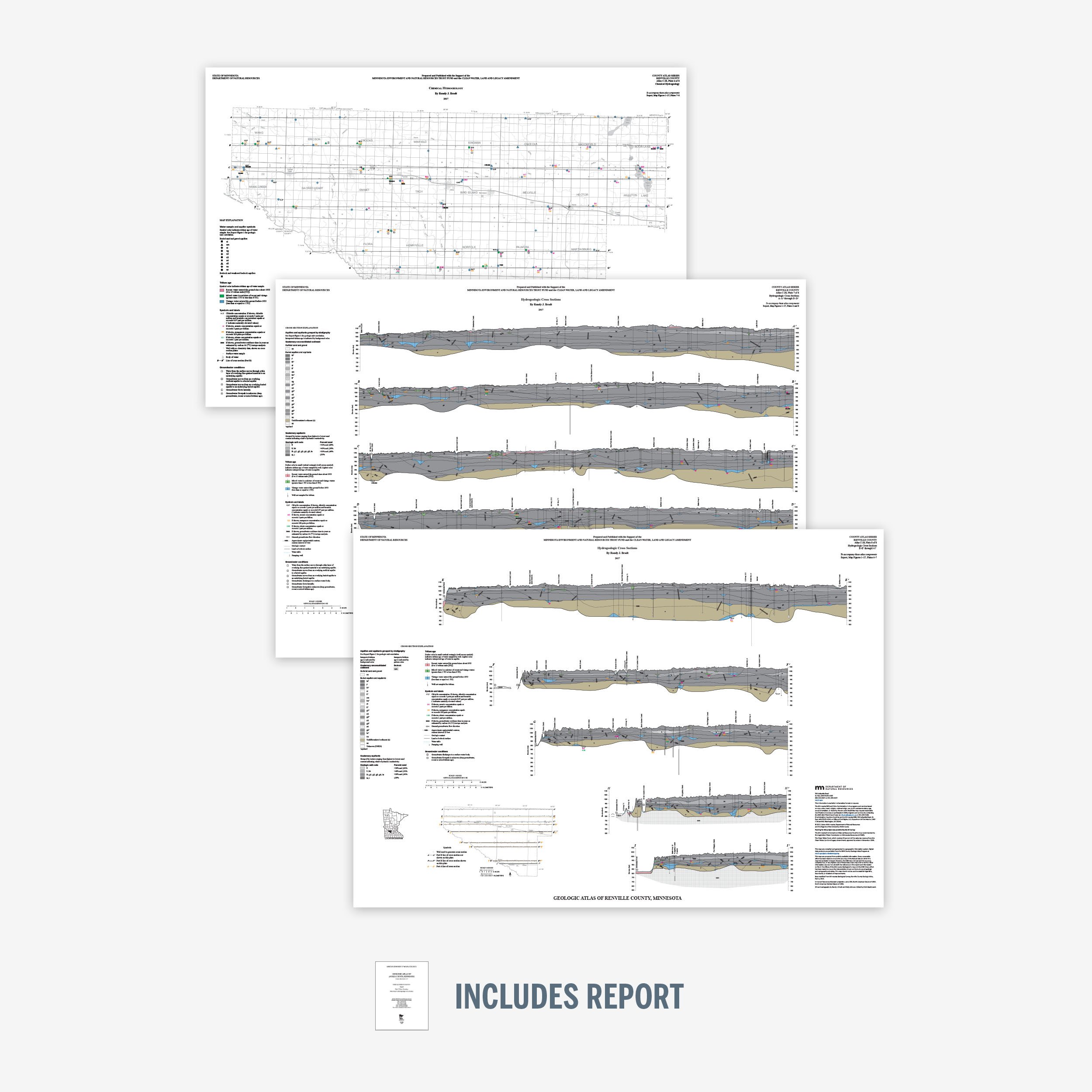
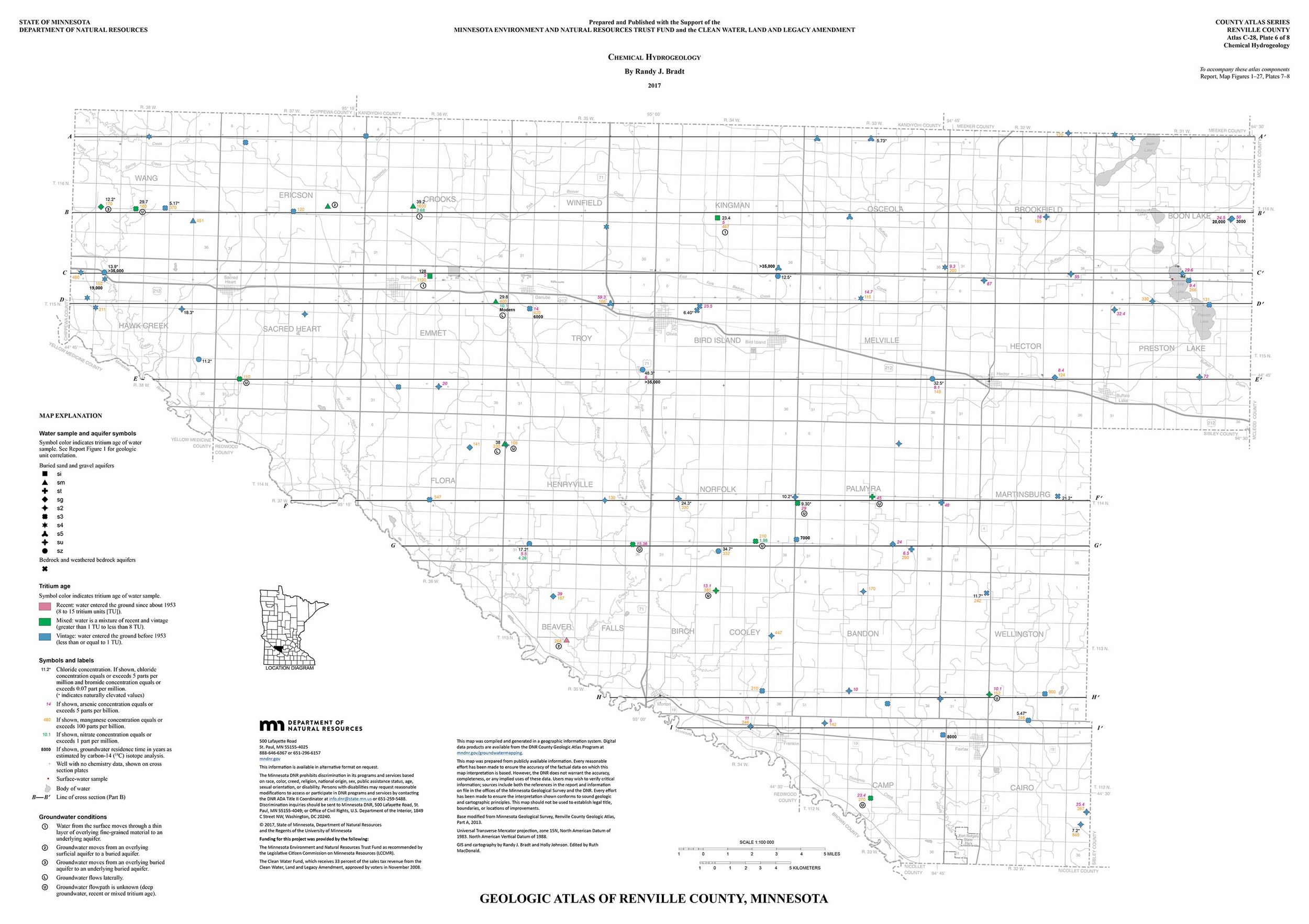
Plate 6 – Chemical Hydrogeology 34x24
Plate 7 – Hydrogeologic Cross Sections, A–A through D–D 37.5x26.75
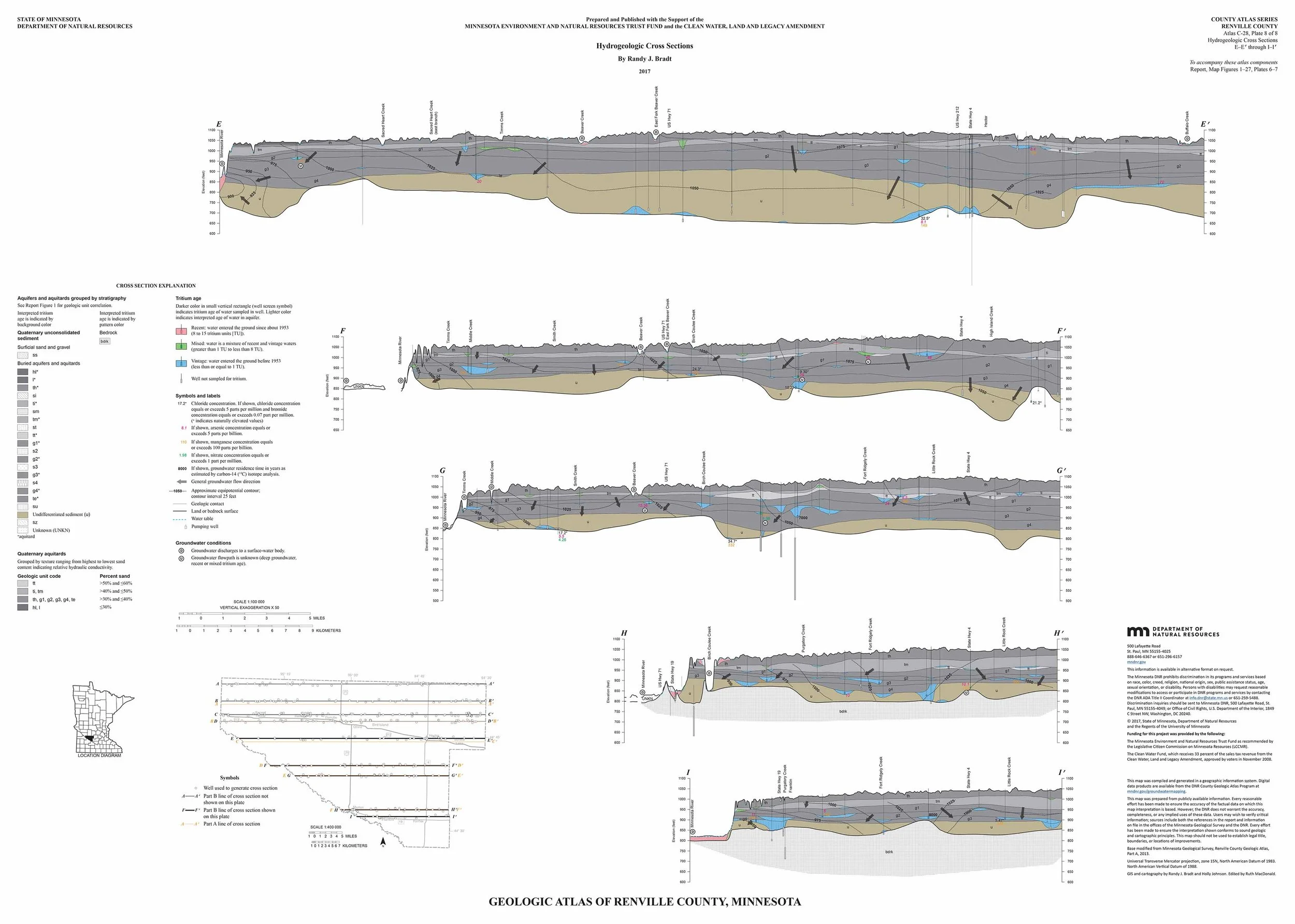
Plate 8 - Hydrogeologic Cross Sections, E–E through I–I 37.5x26.75
These county atlases are provided by the Minnesota Department of Natural Resources.
The Minnesota DNR produces the Part B atlases (Groundwater), which includes plates and reports identifying the direction of groundwater flow, aquifer properties, groundwater chemistry, and pollution sensitivity of aquifers. In older atlases the groundwater information is included in Part A (Geology, published by the Minnesota Geological Survey). See the Groundwater Atlas User Guide (PDF) for an overview of reading Part B (8 pages) and digital versions of the atlases at mndnr.gov/groundwatermapping.
The atlas includes the following pieces, printed by OceanGrafix. Atlas contents:
Part B Groundwater/Hydrogeology: 2017
Report
Plate 6 – Chemical Hydrogeology 34x24
Plate 7 – Hydrogeologic Cross Sections, A–A through D–D 37.5x26.75
Plate 8 - Hydrogeologic Cross Sections, E–E through I–I 37.5x26.75
These county atlases are provided by the Minnesota Department of Natural Resources.
The Minnesota DNR produces the Part B atlases (Groundwater), which includes plates and reports identifying the direction of groundwater flow, aquifer properties, groundwater chemistry, and pollution sensitivity of aquifers. In older atlases the groundwater information is included in Part A (Geology, published by the Minnesota Geological Survey). See the Groundwater Atlas User Guide (PDF) for an overview of reading Part B (8 pages) and digital versions of the atlases at mndnr.gov/groundwatermapping.